
1:25 p.m.
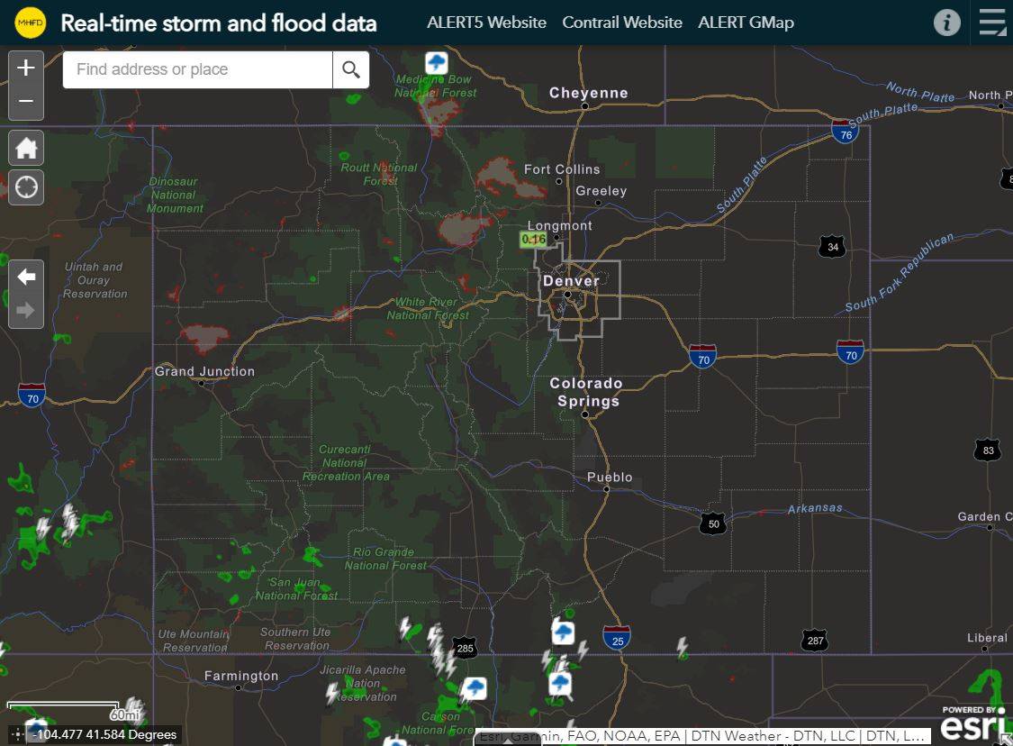
The popularity of this real-time mapping tool is growing rapidly and recent improvements
have been made to the radar, lightning, wildfire burn areas, and storm attribute layers.
Readouts from the ALERT data layers are also much easier to see.
Please check out these enhancements and let us know if you have any problems or
suggestions. We will do our best to expedite needed repairs.
Thank you all for your continued support, and remain diligent in the coming weeks as the
North American Monsoon continues to have its effect on Colorado.
Kevin
[cid:image002.jpg@01D78221.746D49D0]<https://mhfd.org/webmaps/Real-time/>
Kevin Stewart, P.E.
Flood Warning & Information Services Manager
MILE HIGH FLOOD DISTRICT
2480 W. 26th Ave Suite 156-B | Denver, Colorado 80211
Office: 303-455-6277 | Direct: 303-749-5417 | www.mhfd.org<http://www.mhfd.org>
Protecting People, Property, and our Environment
[cid:MHFD-MainLogo-RGB-Color_dc850310-e98b-4e51-9ccb-9e6ba9e6d393.png]
[cid:SocialLink_Facebook_32x32_dddf4d22-a17b-4b5e-a60e-a0d1c141aee6.png]&l...
[cid:SocialLink_Instagram_32x32_a5cf709f-423e-42d0-9b21-63116bf8f89c.png]
<https://www.instagram.com/milehighflooddistrict>
[cid:SocialLink_Linkedin_32x32_b7a2051d-355d-4a7b-b923-ebe2177ea89b.png]
<https://www.linkedin.com/company/udfcd>
[cid:SocialLink_Twitter_32x32_a6576c8a-bc49-4df2-8e65-1ec629178a82.png]
<https://www.twitter.com/mhflooddistrict>
![cid:SocialLink_Facebook_32x32_dddf4d22-a17b-4b5e-a60e-a0d1c141aee6.png]&l...](http://cid:SocialLink_Facebook_32x32_dddf4d22-a17b-4b5e-a60e-a0d1c141aee6.png]%3Chttps://www.facebook.com/milehighflooddistrict%3E)
1622
days inactive
1622
days old
0 comments
1 participants
participants (1)
-
 Kevin Stewart